logo

Footpaths in Walden's Countryside

Click here to start using the interactive map (opens new window)

Click here for ECC report site (opens new window)


The 23 parishes that make-up Walden Countryside are estimated to have about 1200 paths totalling over 900 km (based on the assumption that the average parish has the same density of paths per sq km as does Wimbish).

These paths are by far the most important way of enjoying the countryside that is available to everyone. To take advantage of these paths you need a decent map and for the paths to be adequately signed and protected from illegal blocking and ploughing out by land-owners. This is a duty of Essex County Council but they only carry it out if lack of signs or obstructions to use are reported to them

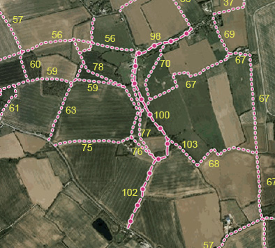
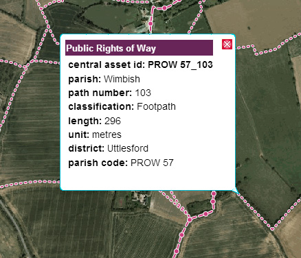
Wimbish, one of the larger parishes in the Walden Countryside area, has about 80 footpaths totalling over 60 km of footpaths, bridleways and green-lane byways. It is used on this webpage as an example of how to create a good footpath map for your area and start enjoying and surveying your countryside

We want you to enjoy footpath walking in your favourite area and, as you do so, to note and report any problems you encounter.


Wimbbih Paths

Copyright 2020
Organic Countryside Community Interest Company
Trading as Walden Countryside
Company number 06794848 - registered in England
VAT No: 947 3003 317

Updated 1 Dec 2020

Top of document


Take a look at this map of part of Wimbish (it shows the area centred on our Scotch Patch, Ellis Green reserve.

It was made using the ECC interactive path map. This shows the aerial photograph with the paths superimposed. Use this ECC web page to choose your area, then make a "screen grab"and save it in a photo-manipulation program like Photoshop.

path details

If you click a path on the interactive map you will get a box giving details of the path.

You can make a list of the path numbers and details in a spreadsheet and use it to record your notes when you walk each path.

It is best to add the path numbers to your aerial photo map (again, using Photoshop or an equivalent free program). You will need path numbers when you report any problems to ECC.

Click here to start using the interactive map (opens new window)

Click here for ECC report site (opens new window)

: